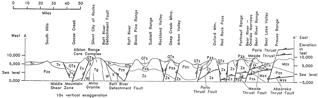
Labels:text | diagram | font OCR: 0 10 20 30 40 50 Miles A' East West A Elevation Bear River - in Bear River Range Oneida Narrows Preuss Range Bear Lake Valley Red Rock Pass Oxford Min. Portneuf Range Arbon Valley Deep Creek Mins. Rockland Valley Raft River Black Pine Range Sublett Range Silent City of Rocks Paris Thrust : Raft River Detachment Fault Goose Creek South Hills Albion Range feet Core Complex 10,000 10,000 QTs OTs Pzs Pzs Meade Thrust QTs OTs OTs OTS Mzs 5,000 5,000 - Tv x Tv QTs Pzs Zs PZS Zs Pzs Pzs Pzs Zs Zs Zs Pzs Sea level Sea level Pzs Tv w X Zs Zs Mzs W Zs Zs Zs Zs IPzs Pzs Mzs -5,000 5,000 Middle Mountain Almo Raft River Shear Zone Granite Detachment Fault Paris Meade Absaroka Thrust Fault Thrust Fault Thrust Fault 10x vertical exaggeration